NetAScore allows to derive indicators for bikeability and walkability index computation from OpenstreetMap network data. By default, OSM data is automatically queried using the overpass turbo API. See also Configuration of the settings for additional options.
Since OSM is maintained by volunteers via open collaboration, attributes might be mapped in various ways. For interpretation of OSM attributes to derive indicator values NetAScore follows the recommended tagging schemes as shown in the OSM wiki, but tries to also cover frequently used alternative specifications.
While some of the NetAScore categories may overlap with OSM categories, there may be some differences. Therefore, please make sure to read the NetAScore indicator descriptions for further information.
More Information about the exact derivation of individual attributes will follow soon!
For now, please refer to the general definition of indicators in Attributes and Indicators and check the source code at sql/templates/osm_attributes.sql.j2.
The Queries given, that were used to request data and form the categories can be tested out using Overpass turbo API, (longer queries are provided as a separately linked .txt file for better readability).
Description: Defines the bicycle infrastructure along a segment in both directions.
| Value __________________ |
Description _______________________________ |
Example ____________________________ |
OSM _________________________________ |
Overpass-QL Query _________________________________ |
|---|---|---|---|---|
| bicycle way | Separate way, that is exclusively used by cyclists | 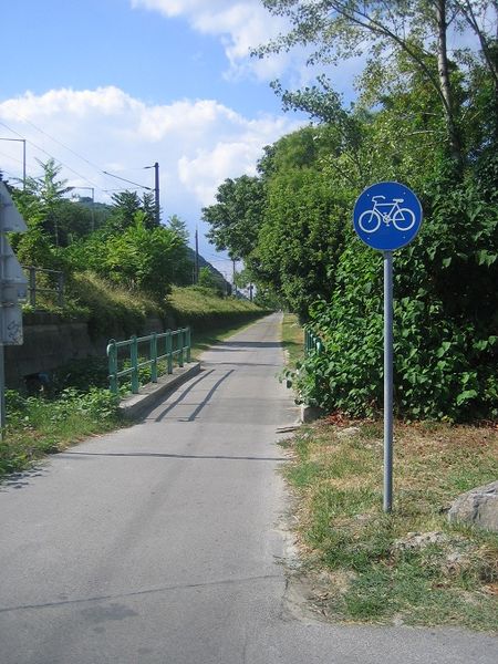 |
bicycle=yes/designated + segregated=yes cycleway=track/opposite_track/segregated/yes + foot!=yes/designated cycleway=track/opposite_track/segregated/yes + segregated=yes highway=cycleway + foot!=yes/designated highway=cycleway + segregated=yes bicycle_road=yes + foot!=yes/designated + maxspeed="" + motor_vehicle=no bicycle_road=yes + sidewalk:*=separate/yes + motor_vehicle=no bicycle_road=yes + segregated=yes + motor_vehicle=no cyclestreet=yes + foot!=yes/designated + motor_vehicle=no cyclestreet=yes + sidewalk:*=separate/yes + motor_vehicle=no cyclestreet=yes + segregated=yes + motor_vehicle=no |
bicycle way query |
| mixed way | Way with mixed use, dedicated to cyclists and pedestrians, but not used by MIV |  |
cycleway=track/opposite_track/segregated/yes + foot=yes/designated cycleway=track/opposite_track/segregated/yes + segregated=no highway=cycleway + foot=yes/designated highway=cycleway + segregated=no bicycle_road=yes + foot=yes/designated + maxspeed="" + motor_vehicle=no bicycle_road=yes + segregated=no + motor_vehicle=no cyclestreet=yes + foot=yes/designated + motor_vehicle=no cyclestreet=yes + segregated=yes + motor_vehicle=no highway=footway + bicycle=yes/designated + access!=no/private + footway!=sidewalk highway=pedestrian + bicycle=yes/designated |
mixed way query |
| bicycle lane | bicycle lane, dedicated to the use by cyclists, e.g. on road-markings or cycle track |  |
cycleway:=lane cycleway:=lane + oneway:bicycle=no cycleway:*=opposite_lane + oneway:bicycle=no cycleway:lane=exclusive/advisory/pictogram |
Bicycle lane query |
| bus lane | bus lane with designated bicycle access | 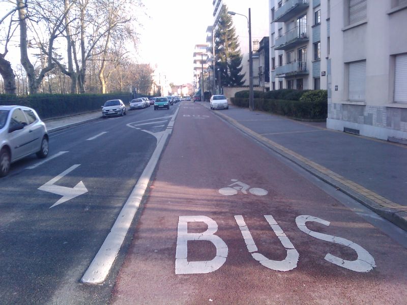 |
cycleway=share_busway cycleway=opposite_share_busway cycleway=opposite_share_busway+oneway:bicycle=no -> Use oneway:bicycle=no together with cycleway:left=share_busway and/or cycleway:right=share_busway, instead. |
nwr[cycleway~"^(share_busway|opposite_share_busway)$"].(area.searchArea) |
| no (or missing value) | absence of any bicycle infrastructure | - |
Description: Defines the pedestrian infrastructure along a segment in both directions.
| Value __________________ |
Description _______________________________ |
Example _________________________________ |
OSM _________________________________ |
Overpass-QL Query _________________________________ |
|---|---|---|---|---|
| Pedestrian area | Road or an area mainly or exclusively for pedestrians. |  |
highway=pedestrian | nwr["highway"="pedestrian"][bicycle!~"^(yes|designated|permissive|destination)$"](area.searchArea) |
| Pedestrian way | Way accessible to pedestrians exclusively and segregated from other traffic. | 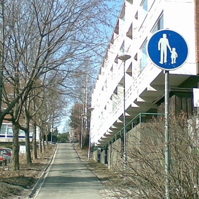 |
highway=footway + footway!=sidewalk + bicycle!=yes/designated | nwr["highway"="footway"][bicycle!~"^(yes|designated)$"][access!~"^(no|private)$"]["footway"!="sidewalk"](area.searchArea); |
| Mixed way | Road designated to pedestrians that is also accessible to cyclists. |  |
See bicycle_infrastructure! | mixed way query |
| Stairs | A set of stairs. |  |
highway=steps | nwr["highway"="steps"](area.searchArea) |
| Sidewalk | indication that a sidewalk for pedestrian access is present on a road. |  |
highway=* + sidewalk=yes/left/right/both/separate | Sidewalk Query |
| no | No suitable pedestrian infrastructure or missing value. |
Description: Designated bicycle routes (in Austria, e.g. Donauradweg), in both directions.
| Value __________________ |
Description _______________________________ |
OSM _________________________________ |
Overpass-QL Query _________________________________ |
|---|---|---|---|
| local | Designates that a road or path is part of a Local Cycling Network route. | network=lcn lcn=yes/proposed |
( nwr["network"="lcn"](area.searchArea); nwr["lcn"="yes"](area.searchArea); ); |
| regional | Designates that a road or path is part of a Regional Cycling Network route. | network=rcn rcn=yes/proposed |
( nwr["network"="rcn"](area.searchArea); nwr["rcn"="yes"](area.searchArea); ); |
| national | Designates that a road or path is part of a National Cycling Network route. | network=ncn ncn=yes/proposed |
( nwr["network"="ncn"](area.searchArea); nwr["ncn"="yes"](area.searchArea); ); |
| international | Designates that a road or path is part of an International Cycling Network route. | network=icn icn=yes/proposed |
( nwr["network"="icn"](area.searchArea); nwr["icn"="yes"](area.searchArea); ); |
Description: Defines the road category along a segment in both directions.
| Value __________________ |
Description _______________________________ |
Example _________________________________ |
OSM _________________________________ |
Overpass-QL Query _________________________________ |
|---|---|---|---|---|
| primary | highway linking large towns | 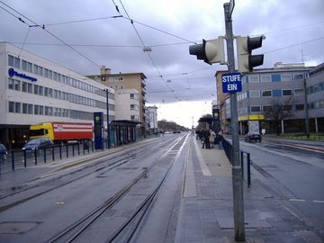 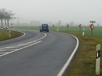 |
highway=primary/primary_link | nwr[highway~"^(primary|primary_link)$"](area.searchArea); |
| secondary | highways which are not part of major routes, but nevertheless form a link in the national route network; cross-regional connecting roads between bigger locations | 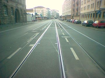 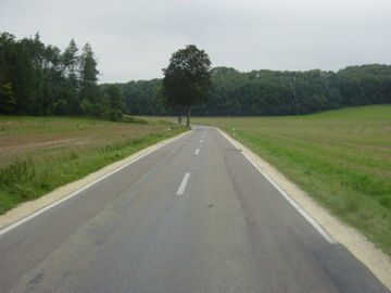 |
highway=secondary/secondary_link | nwr[highway~"^(secondary|secondary_link)$"](area.searchArea); |
| residential | road in residential area, with negligible transit traffic and Minor roads, connecting local centers of a large town or city or smaller settlements | 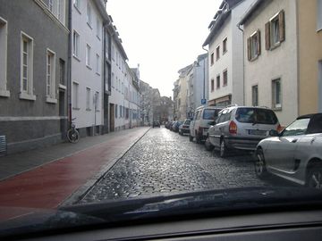 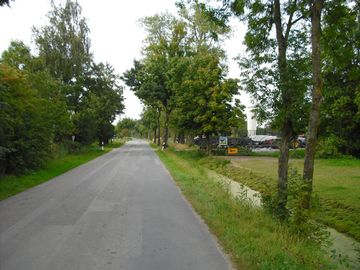 |
highway=residential/tertiary/unclassified | nwr[highway~"^(residential|tertiary|tertiary_link|unclassified)$"](area.searchArea); |
| service | road, whose main purpose is access to a building, service station, beach, business park etc. |  |
highway=service | service road query |
| calmed | Road with very low speed limits and other pedestrian friendly traffic rules. | highway=living_street | ( nwr["highway"="living_street"][access!~"^(no|private)$"](area.searchArea); nwr[maxspeed~"^(20|10|15|4)$"][access!~"^(no|private)$"][motor_vehicle!~"^(yes|designated)$"](area.searchArea); ); |
|
| no_mit | generic or multi-purpose path, not used by motorised vehicles |  |
highway=bridleway highway=track + tracktype=grade1/grade2 highway=path + surface=pave/chipseal/asphalt/concrete/paving_stones/bricks/brickcompacted → see pavement for more info! |
( nwr[highway~"^(bridleway)$"](area.searchArea); nwr["highway"="path"][access!~"^(no|private)$"][vehicle!~"^(no|private)$"][surface~"^(paved|asphalt|chipseal|concrete|paving_stones|bricks|brick|compacted)$"](area.searchArea); nwr["highway"="track"]["motor_vehicle"="no"][access!~"^(no|private)$"][vehicle!~"^(no|private)$"][tracktype~"^(grade1|grade2)$"](area.searchArea); ); |
| track | generic or multi-purpose path, not used by motorised vehicles and with worse conditions than no_mit | 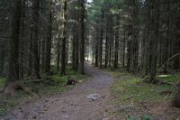 |
highway=path + surface!=paved/asphalt/chispeal/concrete/paving_stones/bricks/brick/compacted highway=track + motor_vehicle=no + tracktype=grade3/4/5 |
( nwr["highway"="path"][access!~"^(no|private)$"][vehicle!~"^(no|private)$"][surface!~"^(paved|asphalt|chipseal|concrete|paving_stones|bricks|brick|compacted)$"](area.searchArea); nwr["highway"="track"]["motor_vehicle"="no"][access!~"^(no|private)$"][vehicle!~"^(no|private)$"][tracktype~"^(grade3|grade4|grade5)$"](area.searchArea); ); |
Description: Defines the pavement of segments.
| Value __________________ |
Description _______________________________ |
Example _________________________________ |
OSM _________________________________ |
Overpass-QL Query _________________________________ |
|---|---|---|---|---|
| asphalt | A feature that is predominantly paved; i.e., it is covered with paving stones, concrete or bitumen and well suited to be accessed by bike |  |
(surface=paved) surface=asphalt surface=chipseal surface=concrete surface=metal |
nwr[surface~"^(paved|asphalt|chipseal|concrete|metal)$"] |
| gravel | A feature that is predominantly unsealed (unpaved); i.e., it has a loose covering , but still has some kind of covering like loose stones or gravel, that eases access by bike |  |
surface=paving_stones surface=bricks surface=brick surface=compacted surface=fine_gravel surface=gravel surface=pebblestone (surface=ground) (surface=unpaved) |
nwr[surface~"^(paving_stones|bricks|brick|compacted|fine_gravel|gravel|pebblestone|ground|unpaved)$"] |
| soft | A feature that is predominantly unsealed (unpaved); i.e., it has a loose covering that considerably hinder access by bike, like earth or grass |  |
surface=dirt surface=earth surface=grass surface=sand surface=wood surface=woodchips (surface=ground) |
nwr[surface~"^(dirt|earth|grass|sand|wood|woodchips|ground|soil|dirt/sand)$"] |
| cobble | cobblestone road, unevenness may be unpleasant while biking. |  |
surface=sett surface=unhewn_cobblestone (surface=cobblestone) surface=grass_paver |
nwr[surface~"^(sett|unhewn_cobblestone|cobblestone|grass_paver)$"] |
Description: Defines the number of lanes along one segment in both directions.
Description: Defines maximum speed for motorized vehicles along segments in both directions.
Description: Defines maximum speed for motorized vehicles.
Description: Counts the facilities (POIs) within a distance of 30 meters along a segment and ratios it to the segment length.
Description: Describes the proportion of the green area within a 30 meters buffer: 0 to 100.
Description: Detects whether a water area is within a 30 meter distance to a segment or if a stream runs along a segment.
Description: Counts the number of crossings within a 10 meter distance to the segment and ratios it to the segment length.
Description: Ratios the area of buildings within a 30 meter Buffer along a segment to the total area of the buffer.